With the new availability of google maps for many countries across Europe and Oceania, I thought it would be interessting to see how the geonames place name labelling algorithm is doing compared to google/teleatlas.
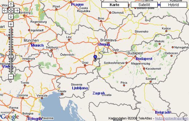
To my big surprise geonames compares very well, it even seems to be doing better. The close cities of Vienna and Bratislava are a good example. Geonames shows Vienna whereas google/teleatlas shows Bratislava. The blue labels are delivered by geonames :
Some of the sites using geonames place name labels are ExploreOurPla.net (use the GHYB overlay switch to turn on google maps hybrid) or globefeed (IE only).
Edit : Noiv, from ExploreOurPla.net, has just sent me these two links :
Region around Vienna with Googlemaps and with MSN Maps.
